

Lower Silesia, the Głogów · Polkowice · Lubin area.
Fields, meadows and forests.
Grodziszcze – a small village.
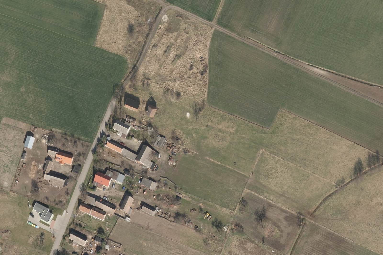
The property is right at its edge.
About 61 ares. House and outbuilding by the road,
behind them a meadow up to the fields.
For sale · Grodziszcze, Grębocice municipality
A brick house with a half-timbered section, an outbuilding and almost 30 ares of your own meadow.
plot boundary (approximate)
Why this place
The last house on this road – beyond it only field tracks. Neighbours on one side only. Privacy, quiet and a sky full of stars.
Approx. 29 ares of farmland / meadow at the back of the plot – room for a pasture, paddock, orchard or simply your own open space. Gardens and crops do well here, and there are several old fruit trees on the property.
As much as several typical suburban plots. Room for a garden, playground and leisure – away from other people's windows.
The front part is covered by the local plan – permitted use includes housing.
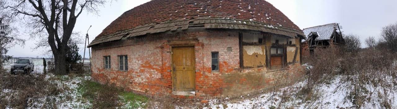
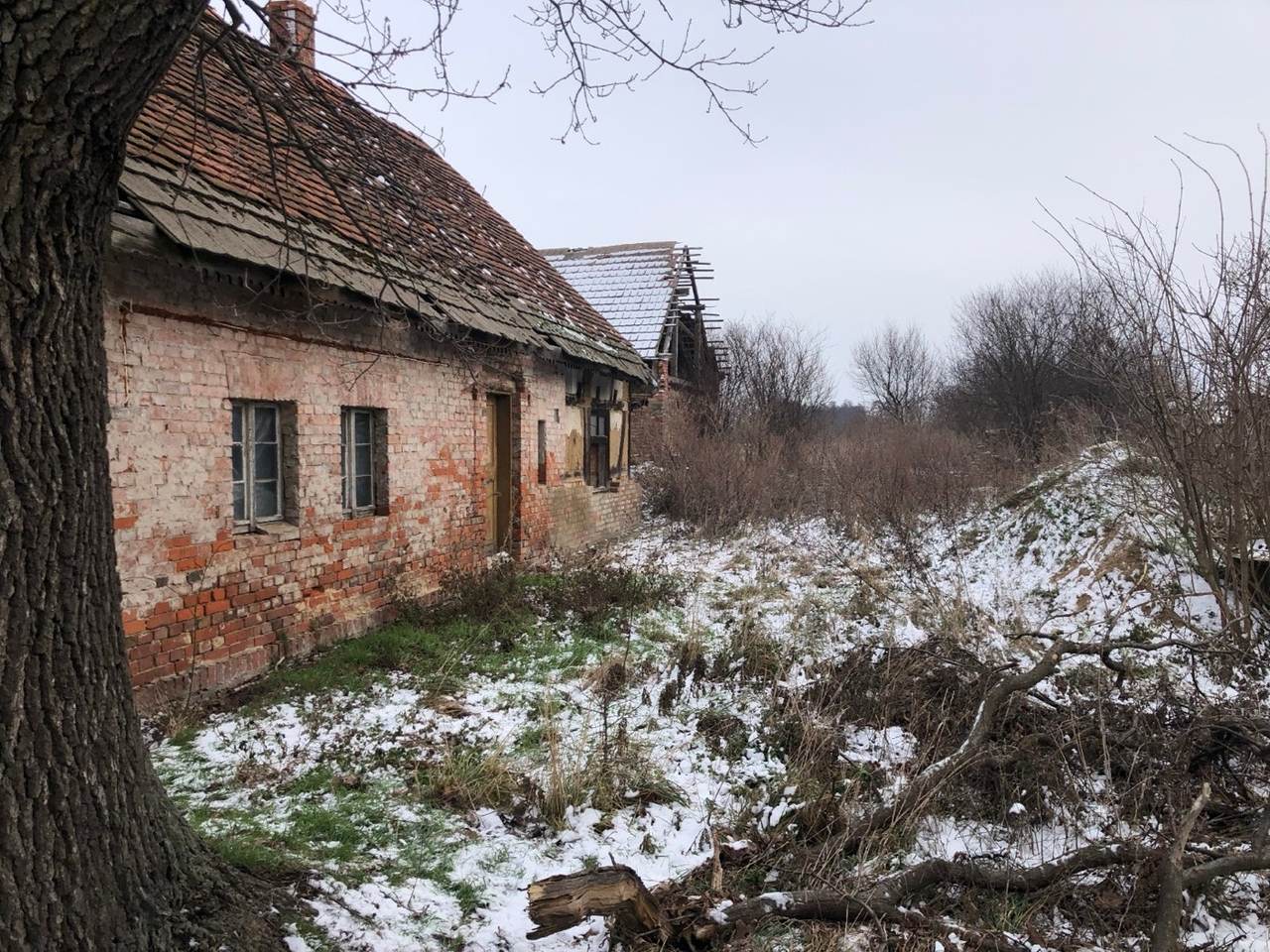
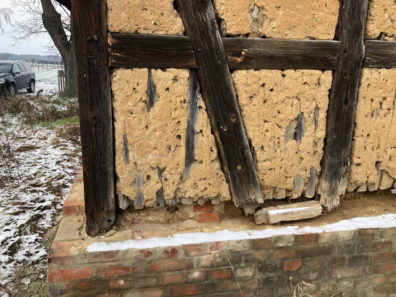
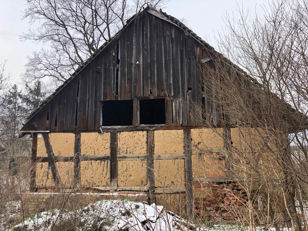
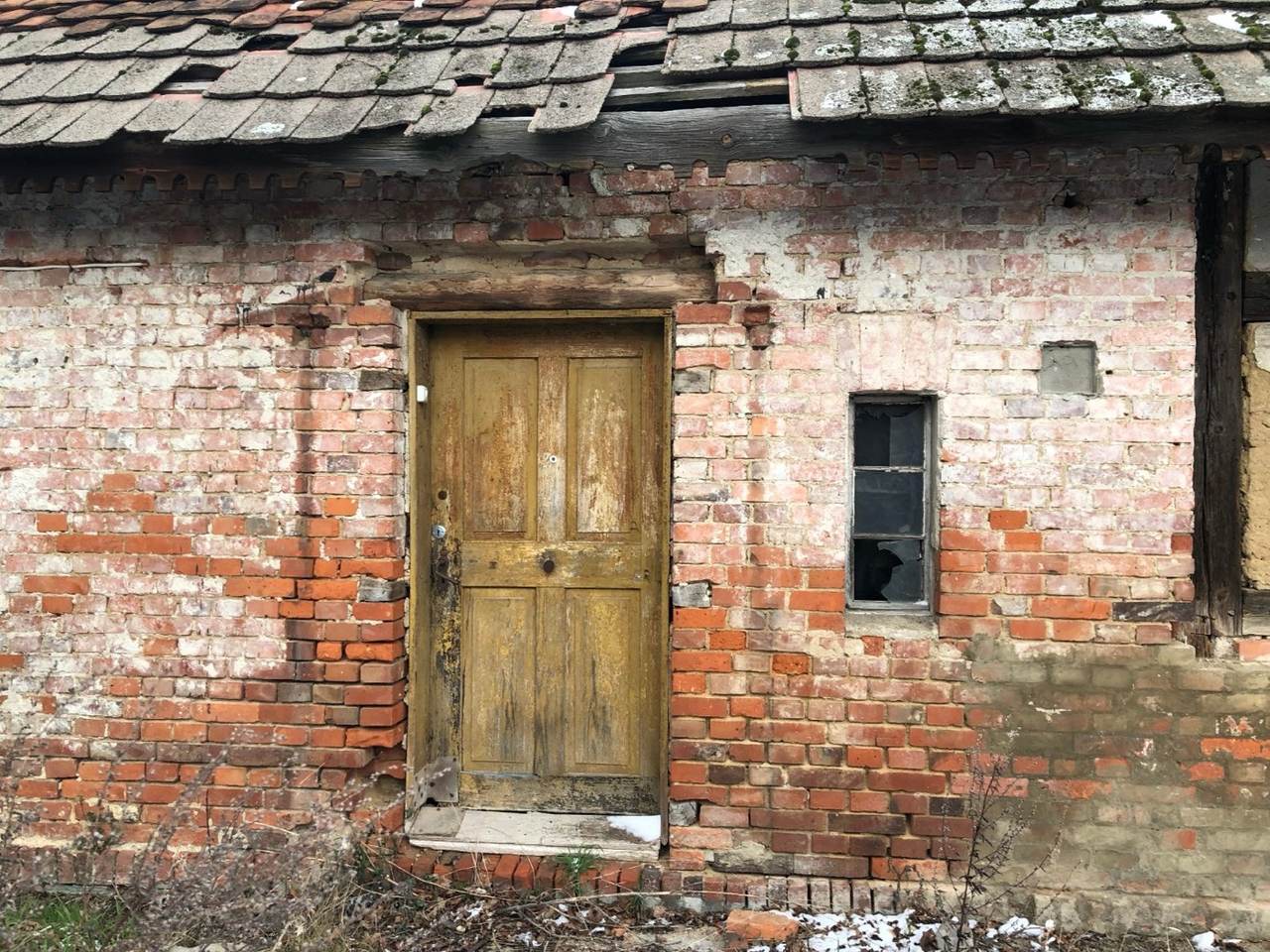
Old, massive beams and brick – most of the beams and walls are intact. Work already done on the foundations, reinforcement, concrete and walls. The interior has been cleared practically down to bare brick – ready for you to plan the renovation.
The local plan allows services alongside housing, e.g. a workshop or studio in a building of up to 200 m² (in line with the plan). Whether a particular business is possible depends on its type, the project parameters and the requirements of the plan and regulations.
A paved road by the house – even heavy concrete mixers have driven along it. A field track runs along the meadow side.
Polkowice, Głogów and Lubin – schools, shopping, doctors and jobs within a short drive.
📍 Directions in Google MapsGrodziszcze is a small village where people know each other. Neighbours are open and helpful when needed – and day to day everyone has their peace.
A small, quiet and friendly community – without the anonymity of a housing estate.
Lower Silesia, the Głogów · Polkowice · Lubin area.
Fields, meadows and forests.
Grodziszcze – a small village.
The property is right at its edge.
About 61 ares. House and outbuilding by the road,
behind them a meadow up to the fields.
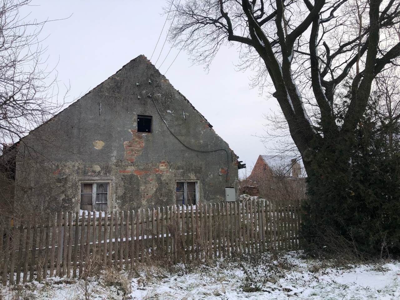
Condition of the building: most of the old, massive beams look well preserved; some need local strengthening or replacement during renovation, and the final scope of work should be assessed when planning it. Most of the brick walls are intact. On the former-stable side, some sections of brickwork need rebuilding or filling in, and most of the half-timbering in that part needs restoring or renovating.
The house is listed in the municipal register of monuments and protected under the local plan (renovation rules – see the description under the plan map above). The owner holds a written heritage-conservation approval for work on the house – available for interested buyers to see.
Areas are approximate and will be confirmed by documents at sale.
Area and investments
Distances and driving times, approximate.
Grodziszcze lies in the Copper Basin – one of Poland's strongest economic regions. Within about 30 minutes' drive are the operations of KGHM Polska Miedź (including in Polkowice, Lubin and Głogów) and the special economic zone in Polkowice with large industrial employers.
Agreement between Polkowice county, Grębocice municipality and KGHM of December 2021: 18.45 million PLN from KGHM to modernise the county road through the village – with a pavement, cycle path and street lighting.
Source: Polkowice county, announcement of 1 Dec 2021Contract signed in September 2026. The new road, approx. 1.6 km with a cycle path, will relieve neighbouring Krzydłowice; value approx. 8 million PLN.
Source: Grębocice municipality, announcement of September 2026An environmental-decision procedure is under way for a solar farm of up to 185 MW (investor: Elawan Energy Polska). The application covers plots in the Krzydłowice cadastral area totalling approx. 216 ha. According to the municipality's notice of 7 Sep 2026, a decision is due by 30 Nov 2026. The nearest plot covered by the farm is approx. 350 m from the property, and approx. 75 m away is a plot designated for supporting infrastructure (e.g. cable lines). The application covers plots, not the final panel layout; implementation depends on further procedures.
Source: Grębocice municipality bulletin (BIP) – notices of the mayor, latest 7 Sep 2026One of KGHM's key investments for the coming decades – part of a new-shaft programme worth at least 9 billion PLN in total.
Source: KGHM Polska Miedź, press release of 14 Nov 2025Information on investments in the area is quoted from the publicly available sources given for each item, as of 6 Oct 2026. It is for information only – the seller is not its author and is not responsible for its content or for later changes to the plans, timing or scope of the investments, which are decided by their developers and the competent authorities. Please check the current status directly with the source.
The photos show the actual condition of the property, without embellishment.
Write via the form – we'll reply and arrange a viewing.
Write / make an offer